
Zahamena National Park – Madagascar’s last great eastern rainforest wilderness
Zahamena National Park has been inscribed as a UNESCO World Heritage Site (no. 1257) as part of the “Rainforests of the Atsinanana”, one of the three largest and best-preserved blocks of eastern rainforest still intact in Madagascar. It stretches across the Alaotra-Mangoro and Atsinanana regions, preserving a complete altitudinal gradient of humid forest from the areas near Lake Alaotra up to the mountain ridges.
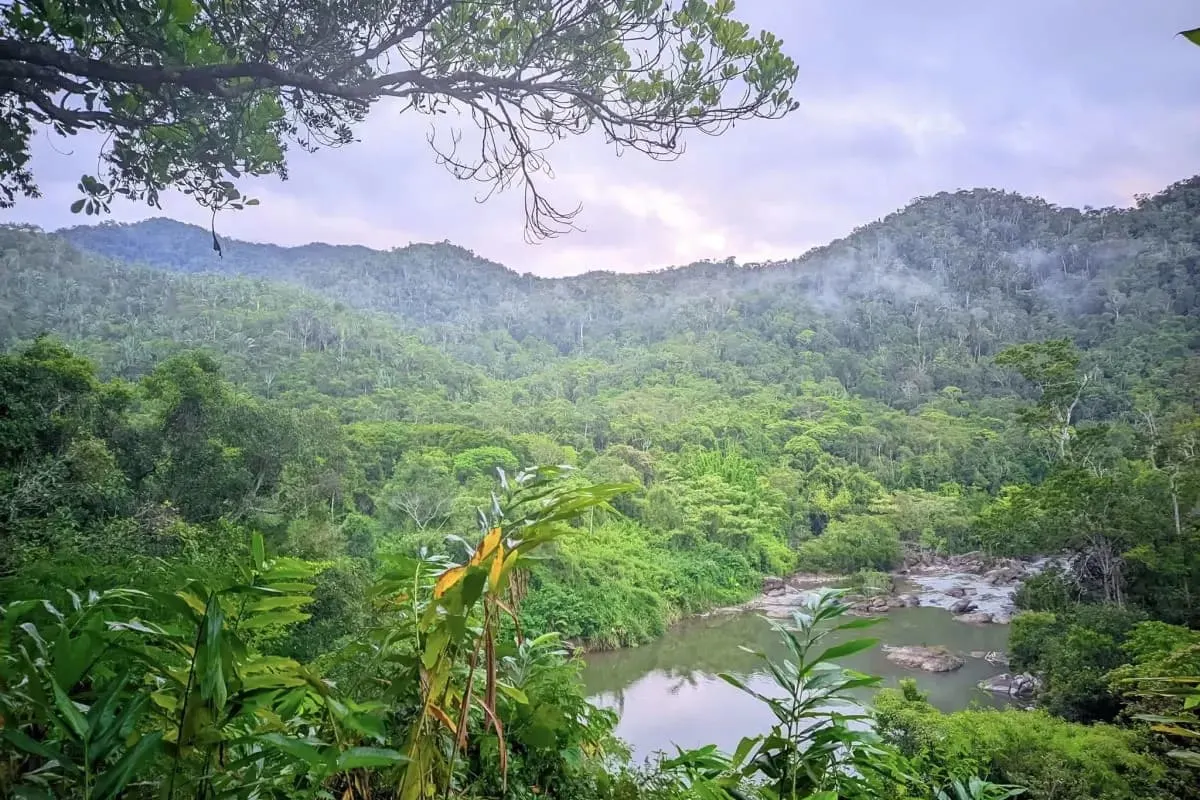
Geography and landscapes
- Location: north-east of Moramanga, east of Lake Alaotra, south-west of Toamasina / Tamatave
- Type: national park of 64,000+ ha + adjacent multiple-use reserves
- Altitude: approximately 400–1,500+ m.
- Terrain: steep hills, narrow ridges, deep valleys.
- Climate: extreme humidity (rain all year round, but especially from November to April).
Ecosystems and habitats
- Lowland evergreen rainforest (400–800 m).
- Mid-altitude forest (800–1,200 m).
- Montane forest with shorter trees (> 1,200 m), moss-covered trunks and epiphytes.
- River, waterfall and forest wetland environments.
Zahamena presents a rare forest continuum between the Alaotra basin and the eastern humid corridor.
Access: Ambatondrazaka – Antanandava – Ankasy
Antananarivo → Ambatondrazaka
Paved road via Moramanga, in good condition.
Estimated time: 6–8 hours.
Ambatondrazaka → Antanandava (Antanadaka)
Extremely degraded unpaved track, 4×4 only. During the rainy season, the roads are simply dug-out earth with mud.
Estimated time: ~2h30.
Antanandava → Ankasy (access village)
About 10 km, but this is the worst stretch: slopes and almost impassable escarpments, huge potholes, erosion. 4×4 vehicles cannot pass without risk of overturning; the side passages are extremely narrow. It is done on foot (or by local motorbike), ~1 hour for a walker in good shape.
Guides, porters and camps are organized here before entering the park through Ankasy. Consider access as a mini-expedition.
Trails and trekking
3–7 day treks from Ankasy
The routes include overnight stays in tents or in a village, deep in the forest.
Ridge walks
Some challenging hikes along ridges with no pollution and access to virgin forest.
Valley and river exploration
From wooded valleys to river crossings, waterfalls and natural pools.
Terrain: very steep, muddy and slippery with no tourist signage; the trek requires good physical condition, waterproof hiking boots and experienced local guides.
Wildlife
- Lemurs: brown lemurs (Eulemur spp.), sifakas, woolly lemurs (genus Avahi), mouse lemurs (genus Microcebus), dwarf lemurs (genus Cheirogaleus).
- Birds: high endemism of the East (vangas, couas, ground-rollers, mesites); large number of threatened species.
- Reptiles and amphibians: chameleons (Calumma, Brookesia), geckos and non-venomous snakes, as well as many frogs of the genera Boophis, Mantidactylus, Guibemantis — all highly micro-endemic.
- Small mammals: tenrecs, native rodents; bats living in the upper forest areas.
Flora and vegetation
- Humid forest trees, typical of humid forests (Lauraceae, Myrtaceae, Sarcolaenaceae).
- Understory with ferns, shade shrubs, litter plants.
- Rich epiphytic flora (orchids, bromeliads, mosses, lichens) in higher areas.
Ecological and cultural role
- Conservation status: a global hotspot for bird and amphibian diversity in rainforests, essential for global biodiversity.
- Hydrology: important river basins that supply water to villages and rice fields in the Alaotra region.
- Local communities: villages (especially Betsimisaraka) depend on the forest for water, firewood and other forest products; participatory management projects exist with MNP and NGOs.
When to go
- May–October (best period): less rain, lower rivers, manageable but difficult access.
- November–April: torrential rains, destroyed trails, dangerous river crossings; access to the park is constantly very limited.
Conclusion
Zahamena National Park serves as an almost pristine refuge for montane rainforest. Its difficult access makes it a niche destination for trekkers and researchers, but the effort and logistics required to reach its challenging landscapes are amply rewarded by one of the most authentic forest experiences in eastern Madagascar.