Fort Dauphin / Tôlanaro
Overview
Madagascar’s Wild Southeast Peninsula of Surf, Spices and Sacred Peaks
At the far southeast tip of Madagascar, where the Indian Ocean’s surf pounds against granite headlands and rainforest‑clad mountains, lies Fort Dauphin, officially Tôlanaro. Wrapped between sea and peaks, it feels more like a remote peninsula outpost than a city: beaches, lagoons, spice gardens, evergreen forests and spiny desert all converge within a short drive.
Founded by the French in the 17th century as a strategic stronghold, Fort Dauphin has long been a gateway between Madagascar and the wider Indian Ocean world. Today, the crumbling fortifications on the headland, Catholic steeples, colonial houses and busy markets sit alongside Malagasy fishing villages and modern mining infrastructure, giving the town a layered, sometimes contradictory character.
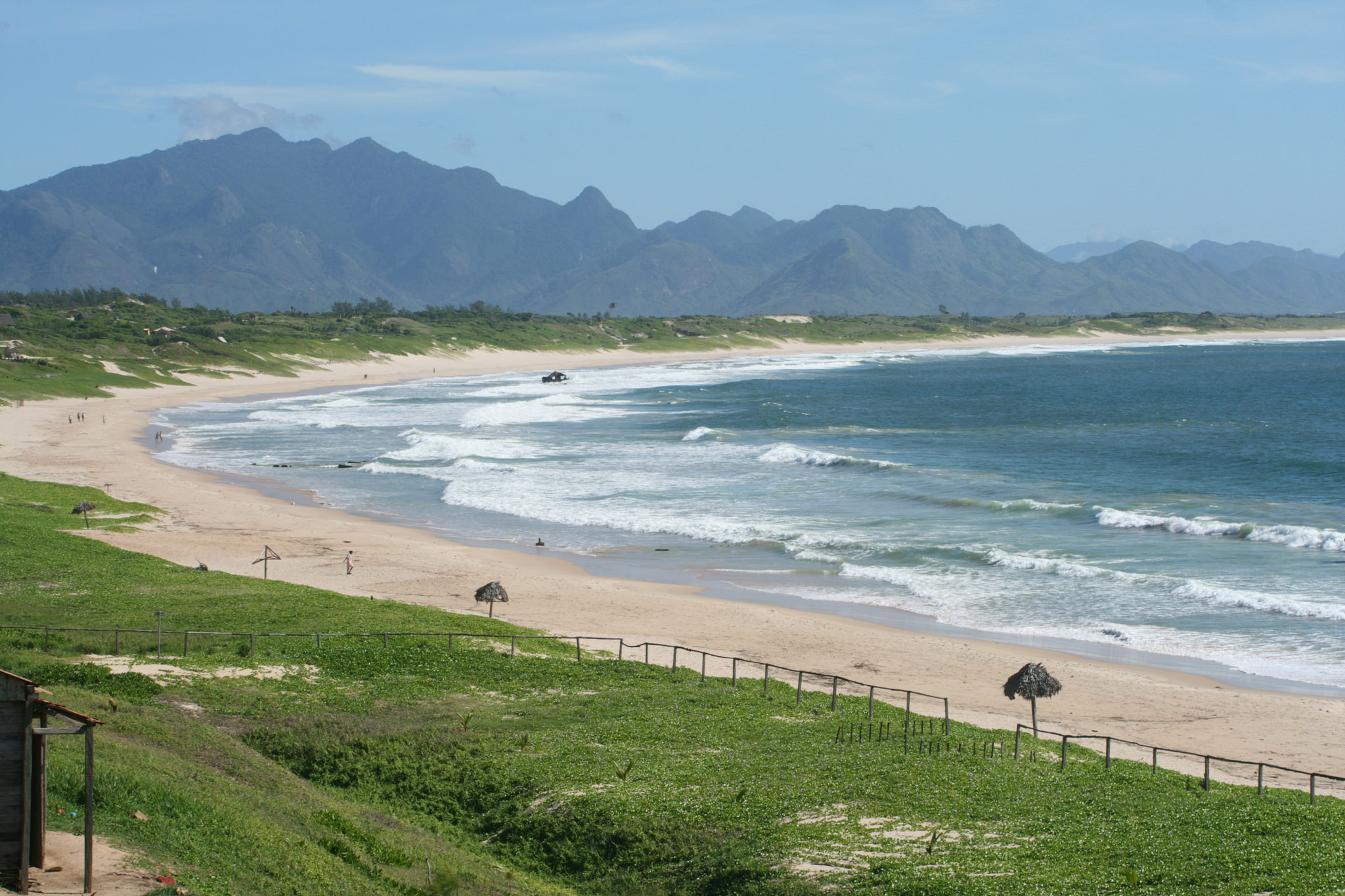
To the north rise the granite heights of Pic Saint‑Louis and the rainforest of Andohahela National Park; to the south and east stretch surfing beaches like Libanona, wild coves, and the lagoons of Lokaro and Evatra; to the west, thorny scrub and spiny forest hint at the arid south. For travellers, Fort Dauphin is one of Madagascar’s most scenic bases for combining sea, mountains and rainforest in a single trip.
1. A Port Built on Wind and Waves
The headland where Fort Dauphin stands was long used by sailors as a shelter from storms. In 1643, the French East India Company established a garrison here and built Fort Flacourt, naming the settlement after Louis XIII’s dauphin. The attempt to create a permanent colony was marked by conflict, disease and isolation, and the French eventually abandoned the fort at the end of the 17th century.
The town remained a modest port for centuries, but its geography — with bays on three sides and a mountain at its back — kept attracting traders, missionaries and, later, colonial administrators. Traces of this past survive in the old fort walls above the sea, in weathered colonial houses and in the street grid that still follows the original French layout.
Today, the port of Ehoala, linked to an ilmenite mine inland, has brought new economic activity. Yet much of Fort Dauphin still feels like a windswept coastal town, shaped more by waves and weather than by modern development.
2. A Peninsula of Contrasts
Fort Dauphin’s greatest attraction is the sheer variety of landscapes within easy reach. The town centre sits on a narrow neck of land hemmed in by beaches: Libanona, a favourite with surfers and swimmers; Ankoba, popular with local families; and more secluded stretches of sand reached by rough tracks.
Inland, the silhouette of Pic Saint‑Louis dominates the skyline. A hike to its summit reveals 360‑degree views: the town and port, white surf lines breaking along the coast, green hills fading into the interior and, on clear days, the distant ridges of Andohahela.
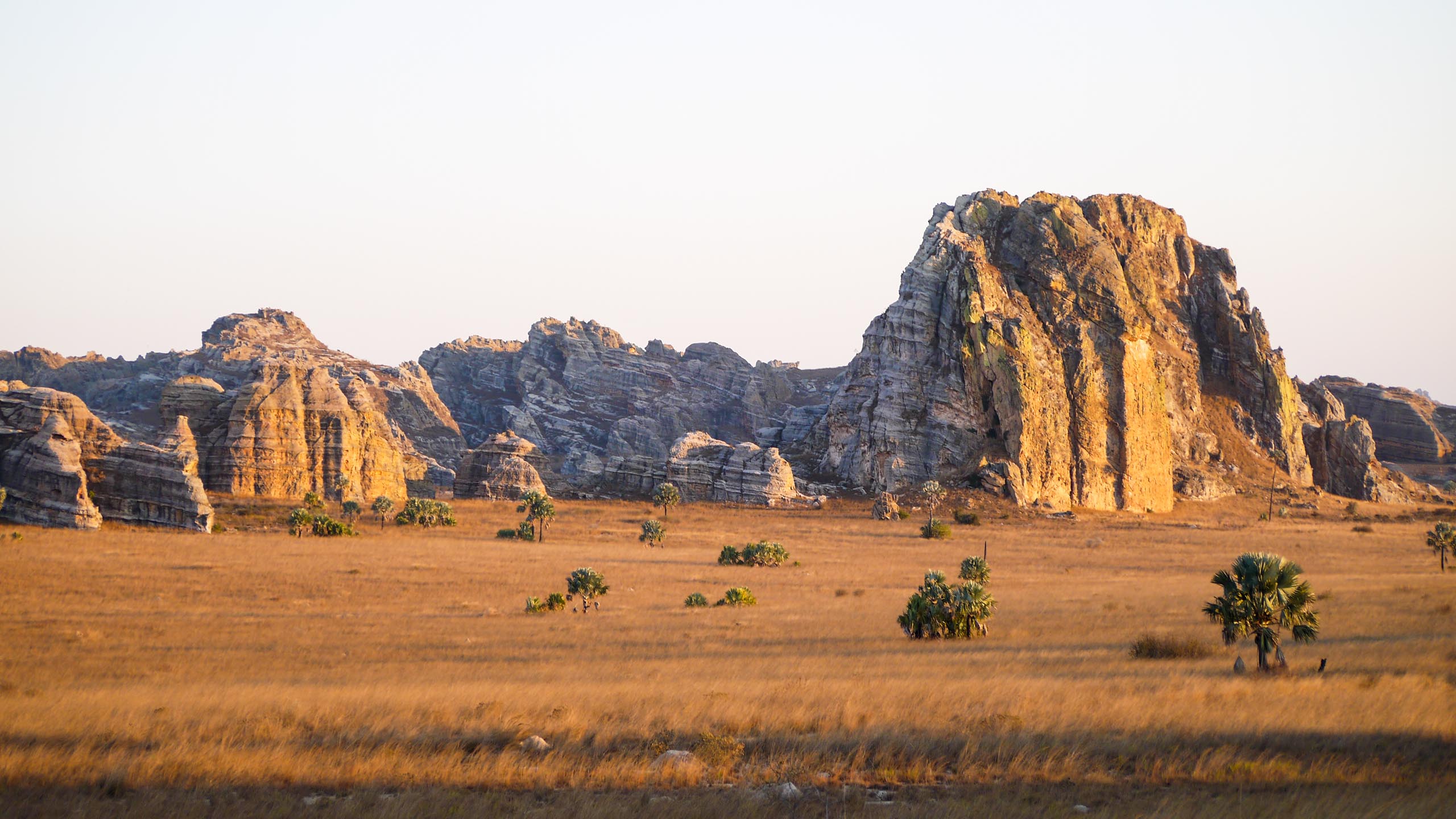
Within a couple of hours’ drive, the ecosystems change radically. The lush evergreen forests and waterfalls of Andohahela National Park give way, on the western side of the range, to dry woodlands and spiny forest where octopus trees and didierea form a strange, thorny “coral” on land. Nowhere else in Madagascar is the transition between humid east and arid south so abrupt and visible.
3. The Town: Markets, Headlands and Libanona Beach
Fort Dauphin’s compact centre can be explored on foot. Around the main market, stalls overflow with lychees, bananas, breadfruit, piles of cassava, baskets of rice and the day’s catch from the sea. The smell of cloves, pepper and other spices drifts from small shops that supply the hinterland.
On the rocky promontory above the port, the remains of the old fort and cannons still watch over the bay. From here, short coastal walks lead along cliffs and casuarina groves with views of the waves crashing far below.
To the south, Libanona Beach curves in a gentle arc beneath casuarina trees. Its consistent swell, sandy bottom and easy access make it the classic swimming and surfing beach of Fort Dauphin. At sunrise and sunset, fishermen launch and beach their pirogues here, while children play in the shallows.
4. Nahampoana Reserve and Andohahela National Park
A short drive from town, the Nahampoana Private Reserve offers an easy introduction to the region’s flora and fauna. Once a colonial botanical garden, it now protects a mixture of riverine forest, bamboo and exotic plantings. Several species of lemurs — including ring‑tailed, Verreaux’s sifaka and brown lemurs — live semi‑wild in the trees, often visible along the paths. Traditional outrigger canoes glide along the river under arching palms and bamboo.
Further afield, Andohahela National Park protects more than 760 km² of varied habitats across the Anosy mountains. On the eastern side, evergreen rainforest cloaks steep slopes, with tree ferns, orchids and waterfalls. On the western side, transition forest and spiny thicket introduce the flora of Madagascar’s deep south. Andohahela is home to lemurs, tenrecs, many endemic birds and rare reptiles, but its remoteness and sometimes rough access mean that visits are still relatively low‑key and adventurous.
5. Lagoons of Evatra and Lokaro
One of Fort Dauphin’s most beautiful excursions leads to the lagoons of Evatra and Lokaro, north‑east of town. A combination of piste, footpaths and boat channels takes travellers through a patchwork of rivers, mangroves, coastal forest and sandbars.
At Evatra, a fishing village at the edge of the lagoon, wooden pirogues carry visitors across the water to beaches and small peninsulas. The mix of calm lagoon, offshore breakers, forested headlands and narrow sea inlets creates a landscape of great variety and constant movement of light. Many travellers choose to spend a night in basic bungalows or camps, waking to the sound of the surf rolling over the bar.
6. Southward: Spiny Forest and Remote Shores
South and west of Fort Dauphin, the road (where it exists) enters a different world: low rainfall, red earth, spiny desert and endless skies. Here grow some of Madagascar’s most emblematic plants: baobabs, thorny didiereas and euphorbias adapted to aridity.
Along parts of this coast, simple fishing villages face an ocean that can be both generous and ruthless. For adventurous travellers with time and a good 4×4, these areas offer a sense of space and isolation impossible to find around the larger northern resorts.Bring light layers, sunscreen, water and a sense of adventure.
Conclusion
Fort Dauphin is not just a town at the end of the road; it is a crossroads of seas, forests and deserts. In a single stay you can surf Indian Ocean swells, paddle through quiet lagoons, hike rainforest ridges and walk under the thorns of the southern spiny forest. For travellers willing to go off the main routes, this wild southeast peninsula offers some of Madagascar’s most dramatic coastal scenery and a deep sense of being truly far away.
Map
Hotels
- Hotel La Croix du Sud
- Ankoba Beach Hotel
- Hotel Talinjoo
When to Go
Visit Fort Dauphin between April and November for sunnier, cooler weather, calmer seas, better road access, and excellent conditions for hiking, surfing, lagoon trips and wildlife watching along Madagascar’s southeast coast.
Activities
- Kitesurfing and surfing at Libanona Beach and nearby breaks
- Rainforest and waterfall hikes in Andohahela National Park
- Lemur and chameleon watching at Nahampoana Reserve
- Boat trips across the lagoons of Evatra and Lokaro
- Hiking up Pic Saint‑Louis for panoramic views of town and coast
- Exploring old French fortifications and coastal headlands
- Day trips into spiny forest and baobab country west of town
- Beach time and swimming on quieter coves around the peninsula
You may also like